Terrestrial laser scanning (TLS) is a 3D method in the field of surveying that enables the non-contact, highly accurate and complete recording of complex measurement objects. It is the most precise method of digitally recording objects.
Laser scanning is used for difficult building structures, large buildings and technical facilities. It can also be used to record specific individual objects or outdoor facilities. The result is a complete digital image that provides any information and visualisation about the construction, structure and lengths of the measured objects. From this, for example, two-dimensional as-built and façade plans or three-dimensional models as well as floor plans, views and sections in the form of CAD plans can be generated. Windows, doors and columns can also be drawn into the CAD plans in detail.
Areas of application
As-built surveys of buildings and parts of buildings
Existing residential and commercial areas, production facilities or storage buildings are measured from the inside as well as from the outside. Based on the resulting point cloud, any as-built plans (floor plans, sections and views) can be created in different levels of detail (LOD). The data is output digitally (in *.dwg or *.dxf format) as well as analogue. The transfer can also take place in the form of a georeferenced point cloud (for example as *.e57 or *.rcp format).
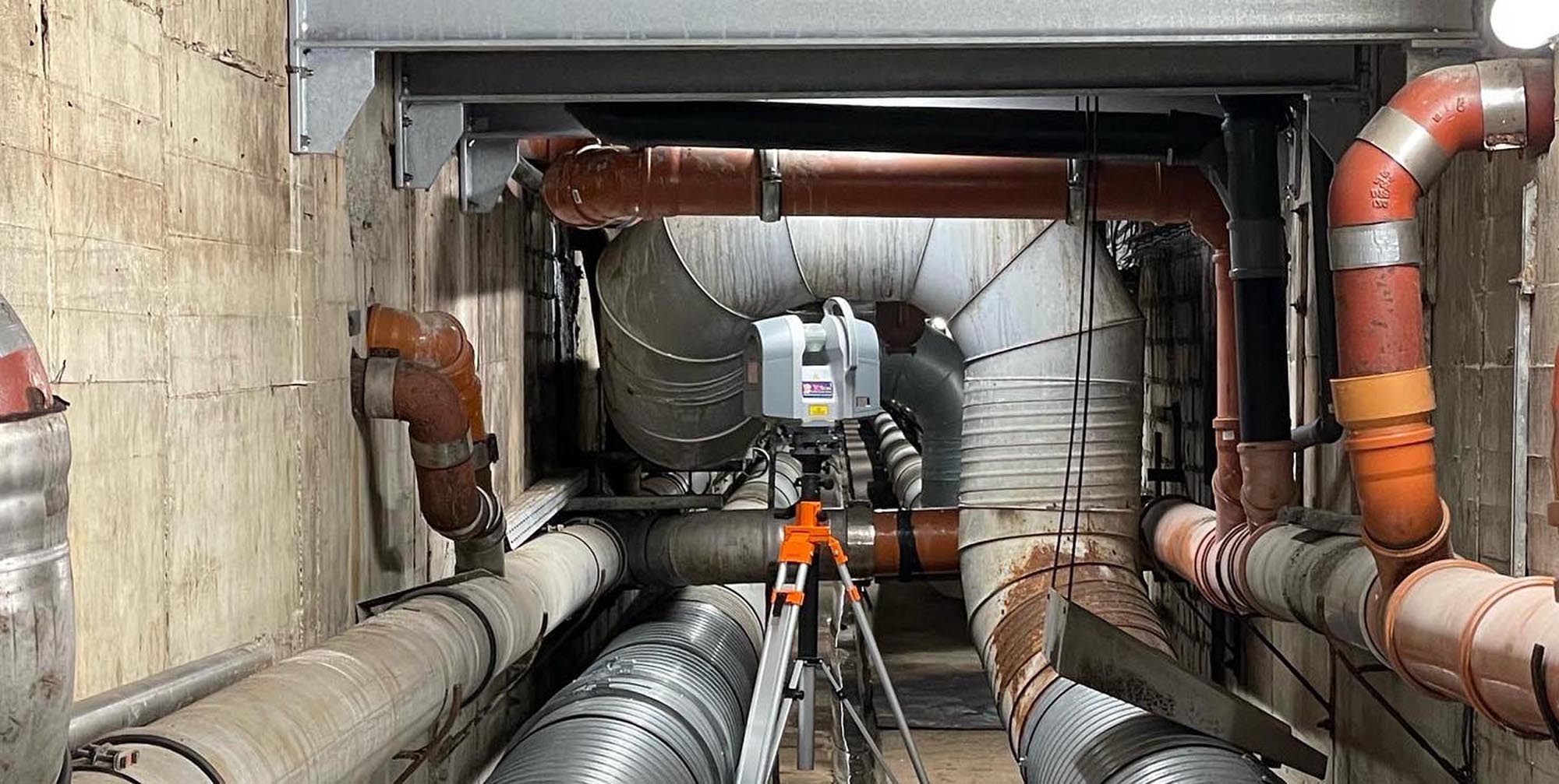
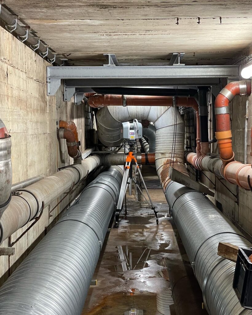
Engineering structures
3D laser scanning is particularly suitable for hard-to-reach and complex structures such as roofs or bridges. Here again, as-built plans of the captured object are created on the basis of the evaluated point cloud. The transfer can also take place in the form of a georeferenced point cloud.
Monument protection and preservation
By means of 3D laser scanning, a deformation-appropriate survey of the listed object is carried out. This is then used to create an exact 2D drawing. On request, we provide facade views, floor plans, building sections and area calculations, which also record component deformations and deformations of buildings in need of major renovation.
Due to the non-contact measuring method, the object is not affected in its state of preservation. In addition to the as-built plans and the point cloud, 360° HDR images can also be output, which can be used for photographic documentation of the measured object.
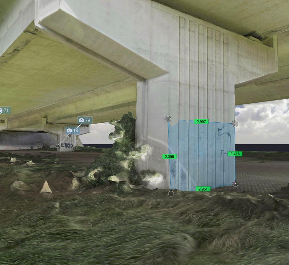
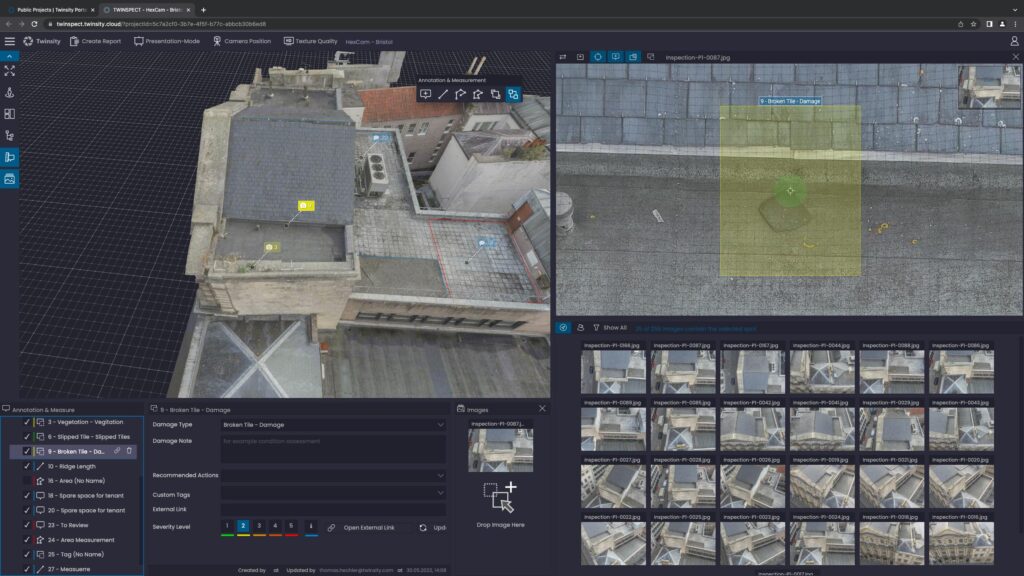
Digital building inspection: thanks to special software, every point can be viewed and documented in high resolution from different perspectives. perspectives can be viewed and documented.
A variety of information such as dimensions and sections can be extracted from the point cloud. The file can be prepared for data import into other programmes (Autocad, 3dsMax, … ).
Laser scanning tecnique
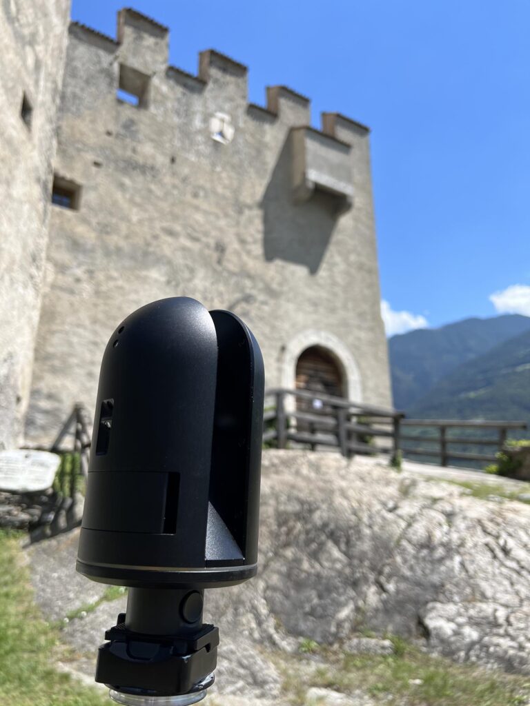
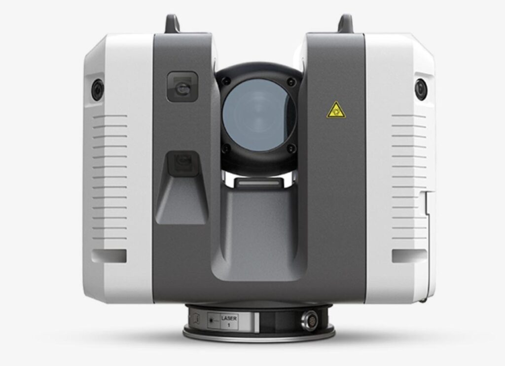
The new Leica RTC360 is one of the most advanced laser scanners in the world. It has a measurement rate of up to 2 million points per second and can create a colour 3D point cloud within 2 minutes. In combination with state-of-the-art drone technology, it solves the most difficult tasks: Volume calculations, building surveying, documentation, inventory and bulk material planning. Furthermore, we also use Trimble TX8 laser scanners.
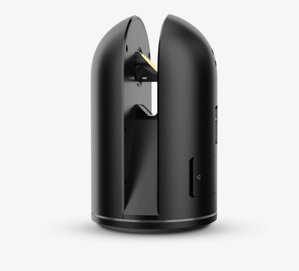
For as-built surveys of buildings with many small rooms, we use the Leica BLK360 3D laser scanner. It has a measuring rate of up to 360,000 points per second. Even dark areas or corners are no obstacle.